KinSource
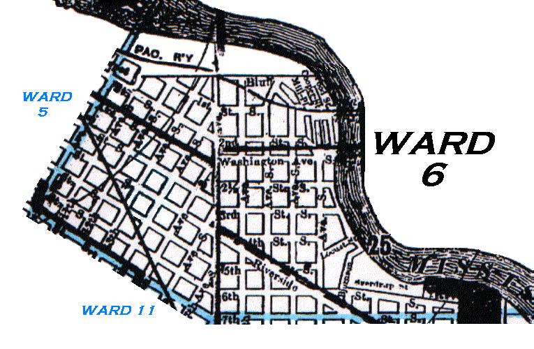
1910 Map of Minneapolis - Ward 6
From Davison's 1910 Minneapolis City Directory
Ward 6 of Minneapolis was bounded as follows:
Starting at the Mississippi River and 7th St S,
west, then northwest on 7th St S to 10th Av S,
northeast on 10th Av S to the Mississippi River,
southeast along the Mississippi River to 7th St S.
Ward Map - Minnesota Historical Society
The western and southern borders of Ward 6 are indicated by the blue line.
Click on the map to enlarge it and launch it into a separate window.
Copyright 2002 KinSource All Rights Reserved