KinSource
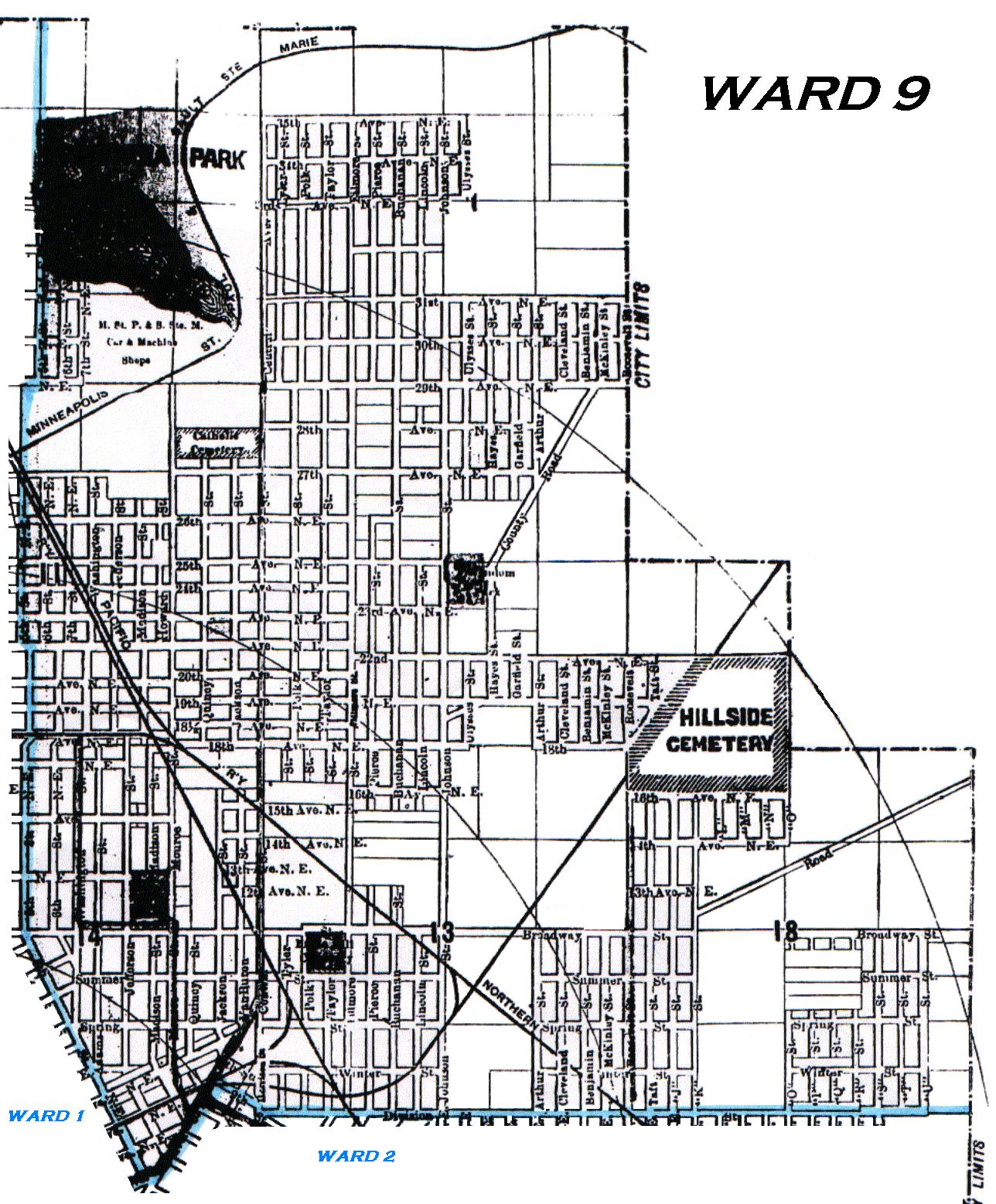
1910 Map of Minneapolis - Ward 9
From Davison's 1910 Minneapolis City Directory
Ward 9 of Minneapolis was bounded as follows:
Starting at the northern city limits (37th Av N E) and 5th St N E,
go south and southeast along 5th St N E to Central Av,
then follow Central Av northeast to 9th St S E,
then follow 9th St S E southeast to Division St. (present day Hennepin Av E),
then follow Division St east to the eastern city limits (Hennepin County - Ramsey County border),
then north along the Hennepin County - Ramsey County border to 18th Av N E extended,
then west along 18th Av N E extended to Hillside Cemetery,
then north along the eastern boundary of Hillside Cemetery extended to 25th Ave N E (present day Lowry Av N E) extended,
then west along 25th Av N E extended to Roosevelt St N E (present day Stinson Blvd) extended,
then north along Roosevelt St N E (present day Stinson Blvd) extended to the northern city limits (37th Av N E),
then west along the northern city limits (37th Av N E) to 5th St N E.
Ward Map - Minnesota Historical Society
The western and southern borders of Ward 9 are indicated by the blue line.
Click on the map to enlarge it and launch it into a separate window.
Copyright 2002 KinSource All Rights Reserved