KinSource
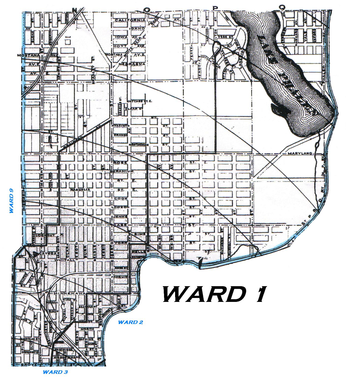
1909 Map of St. Paul - Ward 1
R. L. Polk & Co 1909 St. Paul City Directory
Ward 1 of St. Paul is bounded on the north by the northern boundary of the city,
on the east by the second ward, on the west by the ninth ward and on the south by Grove.
R. L. Polk & Co 1910 St. Paul City Directory
Referencing the City Directory's description for Wards 2 and 9, the boundary of Ward 1 can be described as follows: Commencing at Mississippi St and the northern city limits, go south on Mississippi St. to Grove St., then east on Grove St. to the Northern Pacific Ry tracks, then following the tracks north and northeast to the northern city limits, then west along the northern city limits to the point of beginning.
Referencing the St. Paul City map in Polk's 1909 St. Paul City Directory, the Northern Pacific Ry tracks ran as follows: Starting from Grove Street, running northbound just east of Bradley Street and Bradford Street, then running eastbound just south of Decatur Street and Beaumont Street, then running northbound just east of Payne Avenue to Arlington, then running eastbound just south of Wells Street to the junction of East 7th Street and Earl Street, then running eastbound on the north side of East 7th Street for two blocks, then running northbound to the city limits about one block west of Fisher Street and rounding the southeast corner of Lake Phalen.
The western, southern and eastern borders of Ward 1 are indicated by the blue line.
Click on the map to enlarge it and launch it into a separate window.
Copyright 2002 KinSource All Rights Reserved